Investigating the reasoning behind the catastrophic flood in Boscastle in 2004
Overview
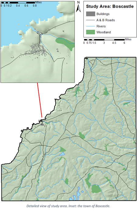
This project required me to apply GIS to an environmental topic; I therefore chose to study the causes of the flooding in Boscastle, Cornwall in 2004. By analysing why the flood was particularly devastating, it was hoped that suggestions could be made as to future action that would prevent a similar event from occurring again. Analysis was performed in ArcGIS, in particular using the Spatial Analyst toolbox and Hydrology toolset.
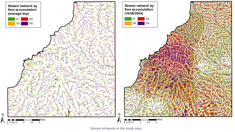
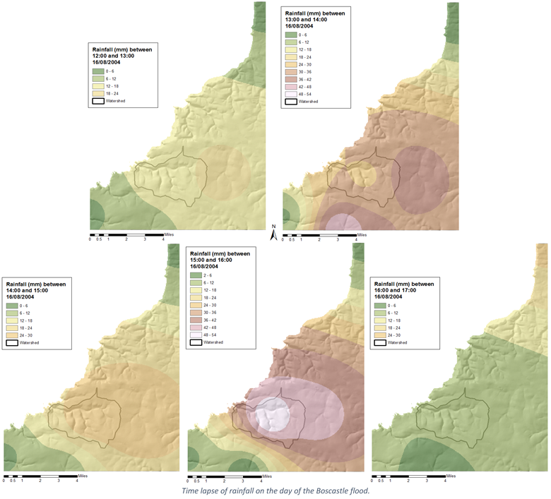
To model the flood, I obtained rainfall data from rain gauges in the area on the day of the event and plotted daily and hourly rainfall models across the study area using the IDW technique. These maps were then used to weight Flow Accumulation maps of the area to observe the volume of water travelling through the river system that day.
Results
The resultant rainfall and flow maps highlighted just how extraordinary the weather event was on the day, therefore it was noted that the extreme conditions clearly played a large part in the severity of the disaster. However, further analysis uncovered several other factors that exacerbated the situation. The study of land usage maps showed that the majority of the watershed was agricultural land, a known contributor to surface runoff. The topography of the watershed also played a part, with the small, steep-sided area causing rapidly-rising floodwaters.
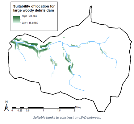
Mitigation factors were briefly touched upon as potential methods to avoid future incidents. Maps were created highlighting areas suitable for the positioning of Large Woody Debris Dams (LWDs) and riparian woodlands within the watershed.