Grass Verge Task

Note: Identifiable information has been removed and any figures have been changed to retain anonymity
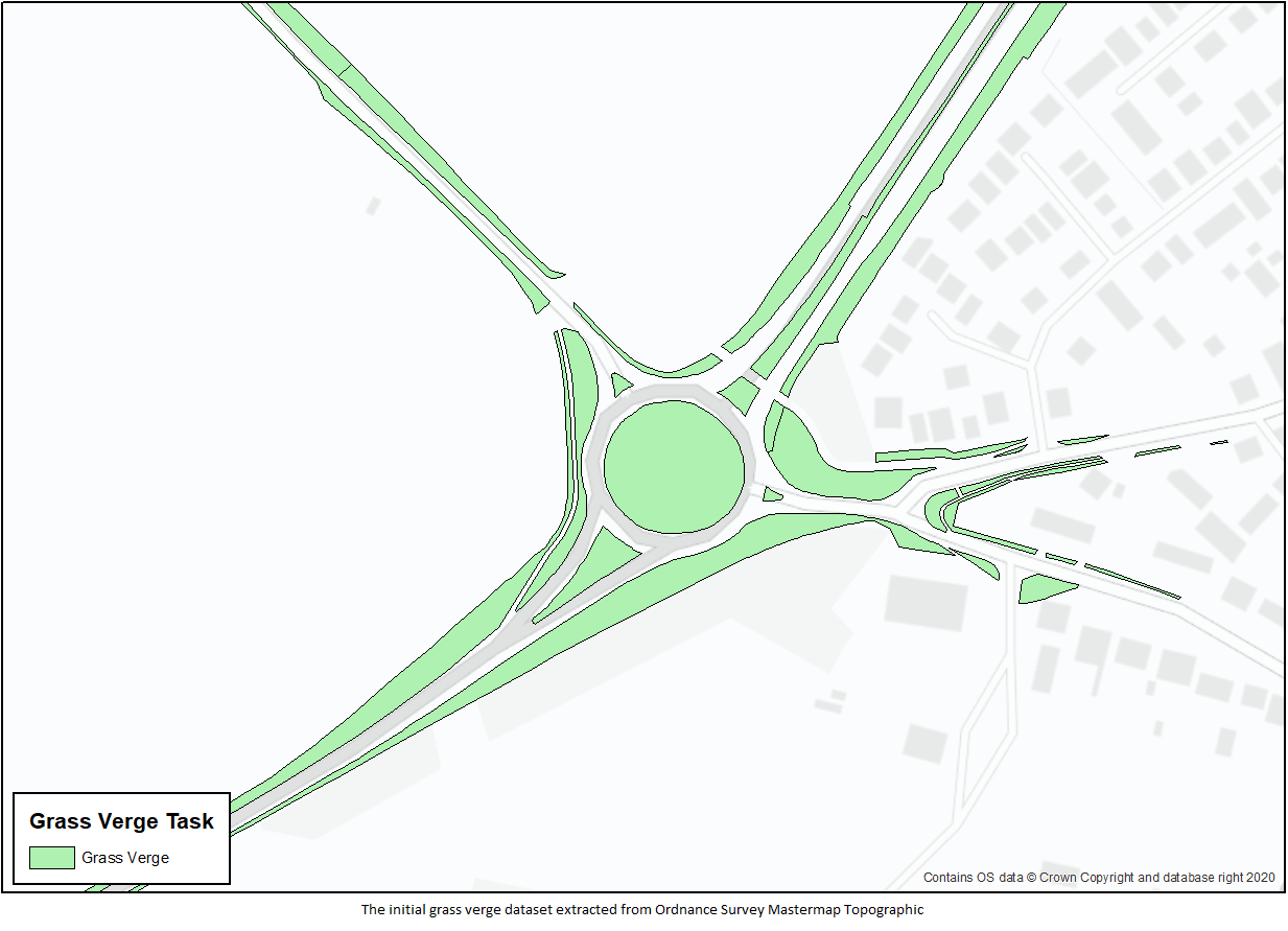
A small but interesting task I worked on was from a client who wanted to obtain grass roadside verge data across a full county and then segment it according to the classification of the nearest road so that crews could visit each verge in turn for a maintenance visit, beginning with verges on A roads, then on B, C and finally unclassified roads. I obtained the grass verge data by filtering OS Mastermap Topography data for the whole county to pull out all features with a DescGroup value containing the word ‘Roadside’ and a Make field equal to ‘Natural’.
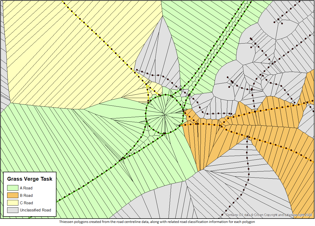
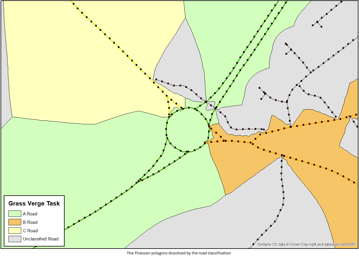
To segment the verges, I obtained road centreline data from the client containing classification information for all roads. I shortened all roads in the dataset by a small amount, then generated points at 10m intervals along the shortened lines, along with end points at both ends. By shortening the lines first, I was ensuring that endpoints at junctions wouldn’t be overlapping so that definition would not be lost in the next stage, which was to create Thiessen polygons from the road points. The Thiessen polygons contained the road classification information passed over from the centrelines which I then used as a dissolve field to merge polygons of the same classification. I then computed a union between the grass verge polygons and the dissolved classification polygons. Those not overlapping the original grass verge polygons were then removed, leaving the grass verges segmented according to the classification of the nearest road centreline.