M-Files Digital Workplace Conference 24 & 25/09/2019

This conference was hosted by M-Files, a new partner of Cadcorp that have embedded the Cadcorp Web Map software within their Intelligent Information Management platform to allow spatial visualisation of data within their software. They invited us along to their Digital Workplace Conference to discuss the recent partnership and why it is mutually beneficial to both companies.
The first day of the conference was intended as an ‘Innovation Day’, therefore I was asked to compose a presentation entitled ‘The Power of Integrations: Why Your Existing Systems Should Talk to Each Other’.
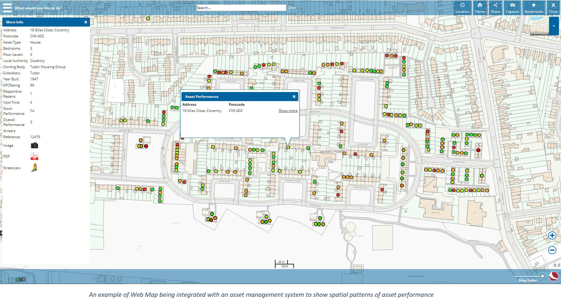
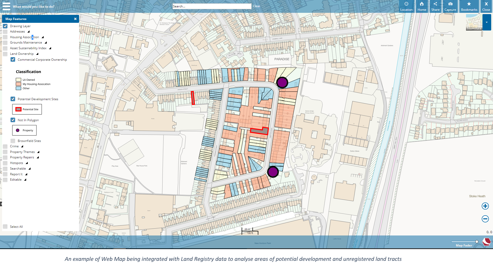
For this presentation, I did a live demonstration of Cadcorp’s Web Map software using sample data similar to that which may be used by a housing association that have chosen to implement the M-Files solution. I explained several areas in which this data could be integrated with external sources to best benefit the business. This included integrating with asset management systems to visualise patterns of data trends; linking with external grounds maintenance and land registry data to provide information to teams within the company; and bringing in contextual crime data to help supplement decision making processes.
After the presentation, I took part in an ‘Ask the Experts’ panel session with the rest of the day’s presenters, in which I fielded questions from conference delegates about the topics raised throughout the day.
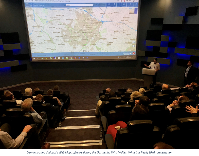
The second day of the conference was designated as a ‘Channel Partner Day’ in which partners of M-Files presented about their experiences and products. For this, I presented a demonstration entitled 'Partnering With M-Files. What Is It Really Like?’.
In this presentation, I spoke about Cadcorp’s Web Map software which had been recently integrated with M-Files’s solution. For this I gave a brief overview of the software and how it could be used to visualise and analyse spatial data over the web. I then discussed the many ways it had been designed to easily integrate with other software; particularly through the use of decorated URLs to open at a particular location or feature, as well as with the ability to embed the map within HTML web pages or other software solutions.