Examining the different techniques for spatial analysis of point data using burglaries in the West Yorkshire area

This report was my first work with linking GIS to criminology. It involved the assessment of various spatial techniques for suitability in representing a point dataset of burglary in the county of West Yorkshire. Several techniques were utilised, that could broadly be split into two categories: point and polygon.
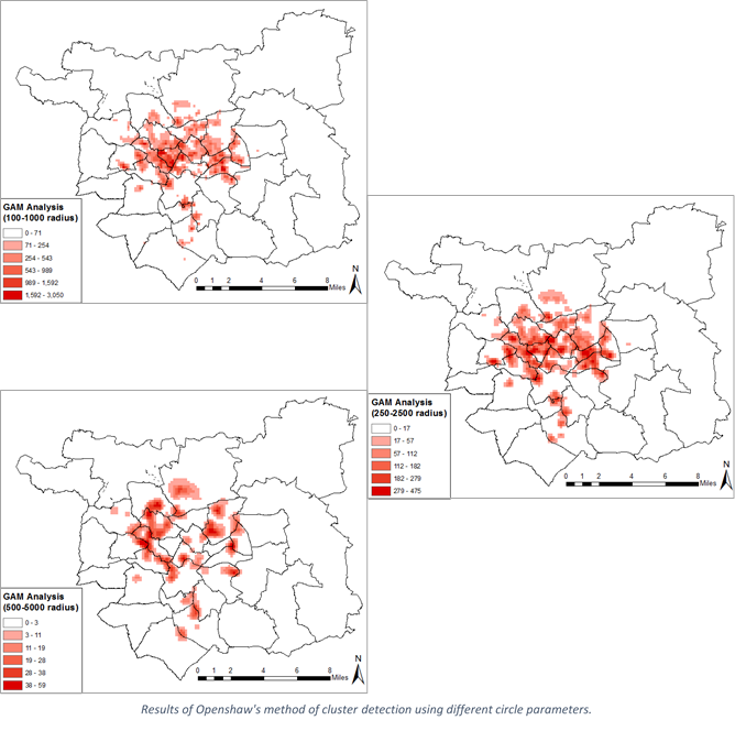
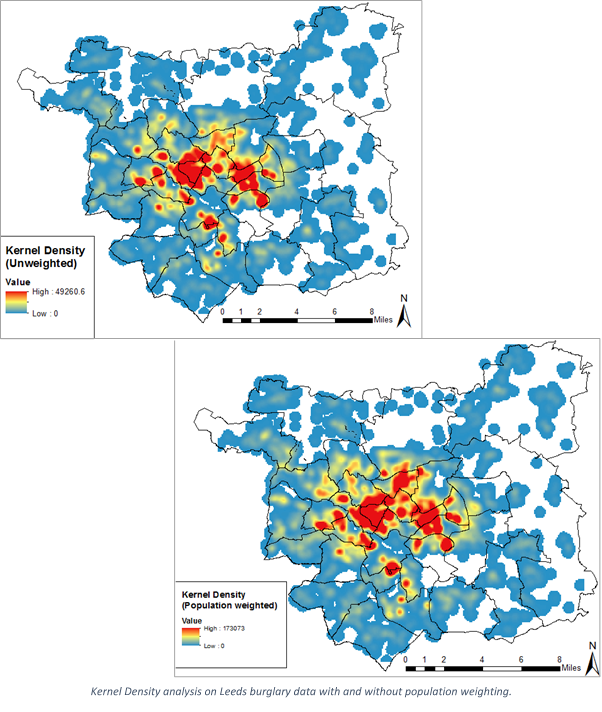
When working with point-level analysis, two methods were trialled. Firstly, Openshaw’s GAM method (Openshaw, et al., 1987) was used to spatially highlight areas of high incidence within the dataset, with different parameters of input highlighted as producing different outputs. Similarly, a raster surface was created using the Kernel Density method to show the concentration of burglaries across the study area.
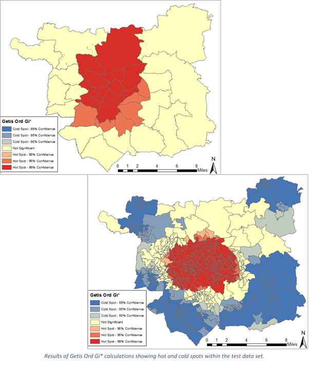
Furthermore, the burglary data was aggregated to both ward and output area level to be analysed using polygonal methods. The Getis Ord GI* statistic was calculated for each polygon to highlight clusters of areas with similarly high and low value. Secondly, the Cluster and Outlier Analysis method was also used, which plots the Anselin Local Moran’s I value to highlight outlying polygons in the dataset where the value is unexpected from the areas surrounding it.
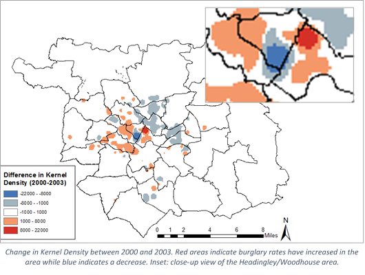
Finally, temporal analysis as performed using the Kernel Density method. The burglary dataset used was split by year and annual maps were generated and compared to show the change in location of burglaries across the time frame used.
References
Openshaw, S., Charlton, M., Wymer, C. & Craft, A., 1987. A Mark 1 Geographical Analysis Machine for the automated analysis of point data sets. International Journal of Geographical Information Systems, 1(4), pp. 335-358.