Investigating the link between proximity to motorways and levels of Limiting Long-Term Illness (LLTIs)
Overview
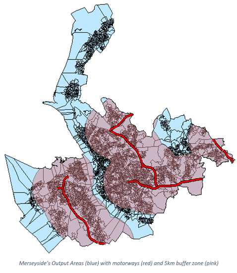
The object of this project was to assess whether the use of a potentially toxic colourant in motorway signs was causing an increase in the number of Limiting Long-Term Illnesses in those that reside near to motorways. To do this, analysis was performed in ArcGIS using geospatial processing and mathematical investigation. The sample study area chosen to test this hypothesis was the county of Merseyside and analysis was performed at an Output Area level using boundary data from CASWEB, which required extensive cleaning to remove polygon errors before it could be used. Furthermore, UK Census Data was collected for the region to give the population and levels of LLTI within each Output Area.
The motorways within the study area were given a 5km buffer to distinguish between areas near to the motorway and those not. Additionally, those Output Areas lying on the border of the buffer zone were divided, with the population and LLTI figures being split according to the amount of the OA that lay within the buffer. This method inaccurately assumed that the population density of each OA was spread equally across its surface; however, without finer-grained data the results were as accurate as possible.
Results
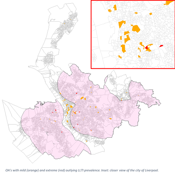
The outcome of the analysis showed that the levels of LLTI remained very similar both within and without the buffer, differing by less than 0.1%. Areas of high and low incidence of LLTI could be found in both sections of the study area. Therefore, no proof could be found to link proximity to motorway and prevalence of LLTI within the Merseyside area. Analysis of the OAs with outlying levels of LLTI seem to point to the effects of inner-city deprivation within the Liverpool area having a greater impact on LLTI levels.