Winter Programme Project
Note: Identifiable information has been removed and any figures have been changed to retain anonymity
A large project that I undertook with KaarbonTech involved the creation of a new collaborative winter services programme for three neighbouring Local Authorities. Previously the three authorities had worked separately when handling yearly road salting, however, during this project, I collated data from all three and created a new cross-border programme where resources were shared.
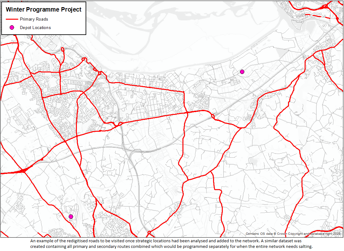
I collated the data I received from the councils into a common format, including redigitising gritting routes into the Ordnance Survey Mastermap Highways road format. I analysed the data at boundaries to remove any duplication of roads that were previously being visited by multiple authorities. I analysed strategic locations and updated the list of roads to grit accordingly to ensure that all schools, hospitals and other essential services would be kept operational during snowfall events; I was able to identify nearly 50 new strategic locations and add them into the programme.
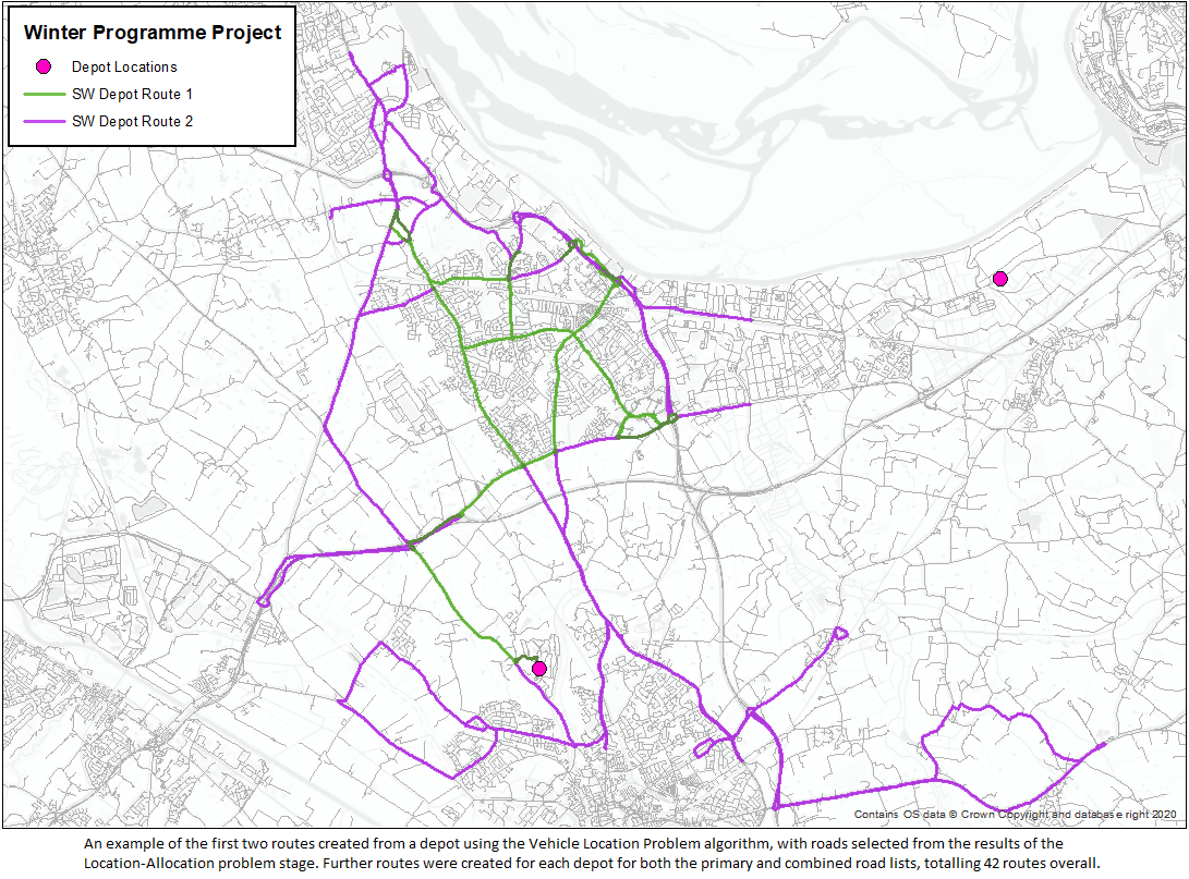
I evaluated the final selection of roads for salting, with the importance of each road being categorised into primary or secondary depending on its significance to the community. I created 20 routes in the area for salting the primary category roads in times of heavy snowfall, beginning and ending at one of the three depots. These routes were optimised and were found to save the council around £3500 in fuel costs and around 6500kg of CO2 over a year. I also generated 22 further routes covering all primary and secondary category roads combined, to be used when the full network requires salting, although no savings could be made through cross-border salting in this scenario.
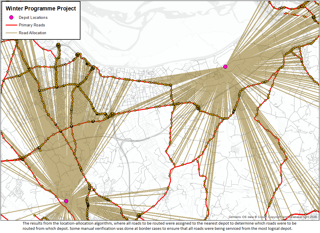
I did the routing section of the project using a combination of advanced routing techniques in Arc Map and Arc Pro. I used the Location-Allocation algorithm to allocate roads to their nearest depot for visiting, with some minor manual verification done at edge cases to ensure the most sensible real-world results. I then used the Vehicle Routing Problem algorithm to concurrently generate the routes from each depot, ensuring that all resulting routes were kept roughly equal in distance. Finally, I recalculated each route in turn using the standard routing tool to ensure they were fully optimised.